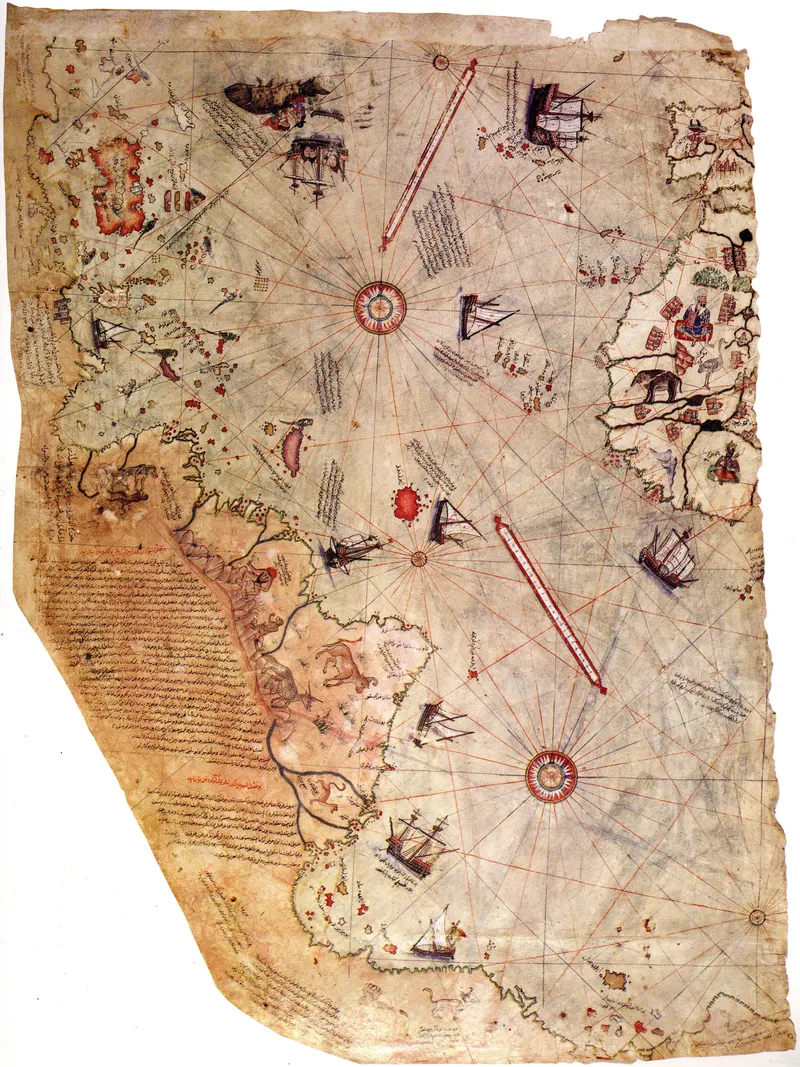
The Piri Reis Map
Piri Reis (Ottoman admiral), 1513
$140
Print check at 12 x 16 in: 163 dpi, good. Fills the print edge to edge.
Shipping to a US address: $24.80 for this piece, from the print room in Charlotte, North Carolina.
Checkout is not open yet. Your cart is saved on this device.
Drawn on gazelle-skin by the Ottoman admiral and corsair Piri Reis, this is one of the earliest surviving maps to show the Americas — compiled, its own notes say, from some twenty older charts, reputedly including one of Columbus's own. Only a fragment survives, showing the Atlantic between the bulge of Africa and a coast of the New World, its interior alive with ships, kings, and monsters. A masterwork of Islamic cartography, and one of the great enigmas of the map.
- Maker
- Piri Reis (Ottoman admiral)
- Date
- 1513
- Medium of the original
- Plate
- Original held by
- Topkapı Palace Museum, Istanbul
- Credit
- Topkapı Palace Museum, Istanbul
- Rights
- Public domain, verified
- Catalogue number
- PA-00317
| Picture | 12 x 16 in |
|---|---|
| Outside size | 13.6 x 17.6 in |
| Depth | 0.9 in (22 mm) |
| Weight | [[REAL PROOF NEEDED: shipped weight per size and frame]] |
| Hanging | [[REAL PROOF NEEDED: hanging hardware Prodigi fits to this frame]] |
| Material | Enhanced matte art paper, 200 gsm; acrylic glazing |
| Made in | Charlotte, North Carolina, by Prodigi |
Before a size goes on sale, the file is measured against it: pixels per inch at that size, how much of the picture a crop would lose, tone and sharpness. A size that fails is not offered, so there is nothing to choose wrong.
| Size | dpi | Grade | How it fits |
|---|---|---|---|
| 8 x 10 in | 245 | Excellent | Trimmed 6.3% |
| 11 x 14 in | 178 | Good | Trimmed 4.6% |
| 12 x 16 in | 163 | Good | Edge to edge |
| Size | Why |
|---|---|
| 8 x 12 in | Wrong shape: a 11% crop |
| 12 x 18 in | Wrong shape: a 11% crop |
| 16 x 20 in | 122 dpi; a historical scan is never enlarged |
| 16 x 24 in | Wrong shape: a 11% crop |
| 18 x 24 in | 109 dpi; a historical scan is never enlarged |
| 20 x 30 in | Wrong shape: a 11% crop |
| 24 x 30 in | 81 dpi; a historical scan is never enlarged |
| 24 x 36 in | Wrong shape: a 11% crop |
| 30 x 40 in | 65 dpi; a historical scan is never enlarged |
| 36 x 48 in | 54 dpi; a historical scan is never enlarged |
| 40 x 60 in | Wrong shape: a 11% crop |
- Scanned
- 2026-10-07
- Master file
- 1,964 x 2,619 px, srgb, sRGB IEC61966-2.1
- Tone
- Darks 93, lights 255 of 255; 12.4% clipped light, 0% clipped dark
- Colour
- 0% vivid
- Sharpness
- 280.41
- Notes
- Pure white on 12% of the image, mostly the sheet itself: it prints as the paper's white
- Neutrals lean warm (yellow): the paper and varnish of the original, kept as scanned
Shipping for this piece to a US address is $24.80, the print room’s own rate, charged per piece. Checkout shows the total before you pay.
Every piece is printed after you order it, in Charlotte, North Carolina, and ships from there. For now we ship to US addresses only.
A piece that arrives damaged, misprinted or in the wrong size is replaced at our cost. The details: shipping and returns and replacements.
Cartographer’s Dream
The world, as the great mapmakers dreamed it.
All 52 pieces from Cartographer’s Dream